Category Archives: hikes
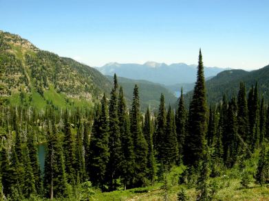
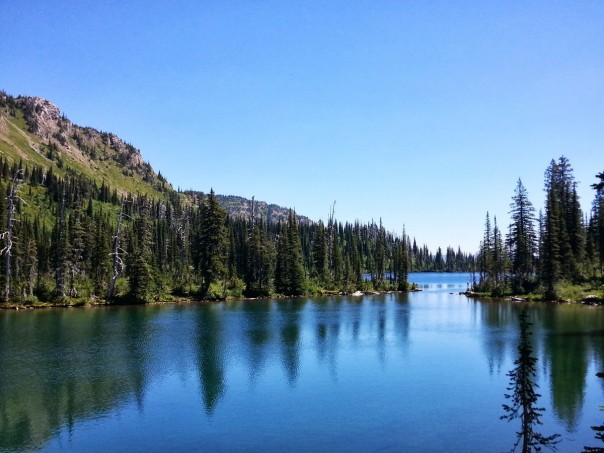
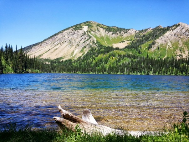
birch lake

Jewel Basin is a gem of a hiking area in northwest Montana located between Kalispell and Hungry Horse Reservoir. It boasts 15000+ acres, abundant wildlife, 27 lakes and 35 miles of trails, most of which are open only to hikers.
Getting to the main access to the area (Camp Misery Trailhead) is a journey itself, heading from Echo Lake 7 miles up a sometimes steep and curvy dirt road (Jewel Basin Rd. #5392). From the trailhead, you can choose between dozens of desired destinations. Though there are signs at junctions marking trail numbers, a map is helpful along the trail.
 From Camp Misery, it is about three miles to the edge of Birch lake via either trail #717 to #7 or trails #8 and #68 to #7. Trail #717 follows the outer edge of a mountain and provides an incredible view of the Flathead. Trails #8 and #68 travel through a more forested area and provide more shade on hot days.
With a gain of less than 1000′ in elevation and plenty of wildflowers to accompany the view, the trek to Birch Lake is a perfect, somewhat relaxed, partial day hike.

 Once there, a 1.5 mile trail follows the edge of the lake where many spots can be found for picnics, fishing, watching for wildlife, swimming, making camp or just taking it all in. Whether this lake is your destination or just a stop along the way, it is exciting to know that it is just the beginning of what Jewel Basin has to offer.
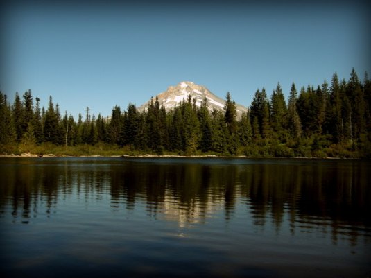
mirror lake
Recently (ok so it was two months ago), I was staying up near Mount Hood and had planned a late morning hike. After doing a little research and getting a couple recommendations, Mirror Lake seemed to be the perfect fit. The trailhead is easy to find just along the southside of Highway 26 between Rhododendron and Government Camp. A Northwest Forest Pass is required to park at the trailhead and can be purchased nearby.
The trail travels about 1.5 miles uphill at a steady pace (total hike is about 3 miles roundtrip with a 750 ft. elevation gain). It is not too strenuous, but is a good workout. Most of the hike meanders through forest and over a small stream here and there, but also offers some great views of the forest.
Once the lake is neared, the trail can be followed in either direction to loop around it. Mirror lake itself does not disappoint. It is a serene little lake with a wonderful view of Mt. Hood. There are several campsites along the trail and a few areas of “beach” to stop for lunch, rock-skipping or reflection.

I am so glad that I stopped for this hike. It was a beautiful day and I had a wonderful time exploring, taking photos, reflecting and soaking up some Oregon sunshine. I will definitely go back!
bridge creek falls and wilson falls
Oregon was given a beautiful weekend recently and my sister and I could not help but venture out to enjoy the sunshine. We headed west out of town and into the heart of the Tillamook State Forest. We first made a stop at the forest center which had information we needed and great exhibits. The center is right along the Wilson river and connects to the river trail.
 We then continued driving west to a big pullout/trailhead along the river somewhere near mile marker 20, I think. There is a bridge across the river at this spot. Bridge Creek Falls is practically right next to the highway across from this pullout, though it could be easy to miss when driving. We parked and took the short trek up to the falls.
From there we went back across the highway and crossed over the river, stopping on the bridge to view the vitamin D-deprived northwesterners that were cliff-jumping, fishing, floating and soaking up the sun. On the other side of the bridge, we connected to the Wilson River trail. We were a little confused about the trail here and there, but it wasn’t too bad. The Wilson River Trail actually extends 11 miles along the river through the forest which is great. We followed it eastish about 1.5 miles to Wilson falls where we stopped and enjoyed the sunshine and a snack.
Both of the falls we visited were nice and made for a simple day out with plenty of photo opportunities. We had planned on another hike up to University Falls on the way back to town, but we killed a lot of time enjoying the sunshine and exploring the forest center and campgrounds. It will be a great new hike for another day!
Once again, a short trip outside of Portland has proved to be a rich and refreshing getaway and I look forward to going back.
wahclella falls
 Recently, I took a quick trip with friends on a new hike in the Columbia Gorge. Sometimes I wonder if it is even possible to see all the waterfalls in the gorge. (I’ve heard there are at least 100 on the Oregon side) We visited several falls that day, but the only real hike was to Wahclella falls.
The trailhead for the falls is located near exit #40 off I-84, which is just under 10 miles east of the very well known Multnomah falls. The parking lot is just to the south of the exit (look carefully for signage) and does require a permit (NW Forest Pass and National Parks Pass both work) or you pay a $5 parking fee on site.
The hike itself is pretty easy and family friendly, only about 2 miles roundtrip with minimal elevation gain (300 feet or so). The trail has a junction as you near the falls and it simply makes a loop. I recommend merging right at that point, but either way gets you to the falls.
 The falls itself is beautiful with the lowest tier falling up to 70 feet into the pool below. The upper part of the falls can actually be either one or two additional falls depending on the season.
This was a simple, beautiful and fun hike in the gorge and I will definitely visit again!


